Kalimantan Forest and Land Fire Hotspot Soars, 3 Japanese Chinook Helicopters Ready for Water Bombing
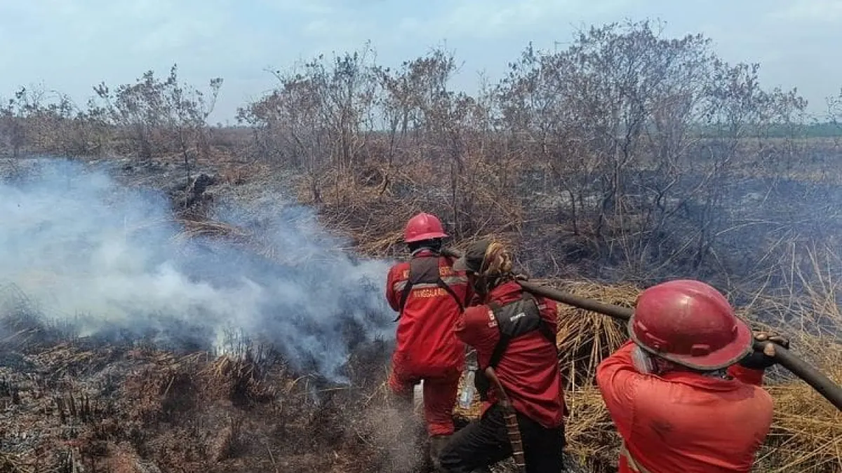
JAKARTA, GARISBUMI.com – Control of forest and land fires or karhutla was strengthened in Kalimantan after the number of Hotspots with a high level of confidence increased sharply. Three CH-47 Chinook helicopters from Japan are now being prepared to assist in aerial firefighting operations.
Data from the Ministry of Forestry's Forest and Forestry Monitoring System or SiPongi recorded 688 high confidence Hotspots throughout Indonesia as of Friday, September 11 2026, at 21.15 WIB. This number increased compared to the previous day which reached 569 points.
Central Kalimantan (Kalteng) is the region with the most Hotspots among the six priority provinces for controlling forest and land fires. The number jumped from 96 to 271 points.
The increase also occurred in West Kalimantan (Kalbar), from 39 to 51 points, and South Kalimantan, from nine to 47 points.
In contrast to Kalimantan, conditions in a number of areas of Sumatra show better development. Riau and Jambi did not record high confidence Hotspots in the last monitoring.
The day before, Riau still recorded 18 points and Jambi two points. Meanwhile, Hotspots in South Sumatra (Sumsel) fell from 34 to 11 points.
Even though the number of Hotspots has decreased, patrols and prevention are still carried out. Forest and land fire conditions can change depending on the weather, the level of drought, and the availability of flammable materials in the field.
Hotspots Are Not Necessarily Indicative of Fire
The Ministry of Forestry explained that Hotspots are an indication of surface temperature anomalies detected by satellites. SiPongi data comes from NASA Terra/Aqua, SNPP, and NOAA-20 satellite monitoring.
One hotspot does not always indicate one fire incident. Conversely, one fire location can be detected as several Hotspots.
Therefore, every monitored point must be checked through direct monitoring or groundcheck. The results of the examination are used to determine the location and form of surgery required.
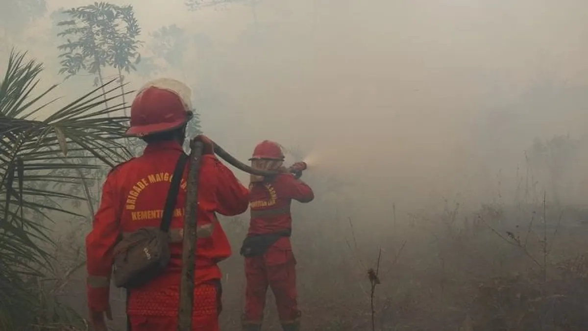
Manggala Agni together with the TNI, Polri, BNPB, BMKG, BPBD, local government, community and business world continue to carry out patrols, ground extinguishing, fire blocking, wetting and cooling.
Handling in peat areas takes longer because embers can persist below the surface even though the fire is no longer visible.
Japanese Chinook Arrives in West Kalimantan (Kalbar)
Forest and land fire air operations now have additional strength in the form of three CH-47 Chinook helicopters belonging to the Japan Ground Self-Defense Force.
The three helicopters were brought aboard the Japan Maritime Self-Defense Force ship JS Kunisaki and have arrived at the Kijing Terminal, West Kalimantan (Kalbar). The helicopter will undergo technical preparation and flight tests before being used for water bombing operations.
Japanese support involved approximately 180 personnel. Supervision of helicopter operations is under the TNI, including for security, flight permits and deployment of safety officers. The flight mission is coordinated with BNPB.
This assistance is part of the cooperation between Indonesia and Japan in the field of humanitarian assistance and disaster management or Humanitarian Assistance and Disaster Relief.
The presence of Chinook is expected to strengthen aerial firefighting, especially in areas that are difficult to reach by ground teams.
The government had previously alerted 53 air fleets in six priority provinces. A total of 34 fleets are used for water bombing, while 19 others are used for air patrols and supporting Weather Modification Operations.
The deployment of planes and helicopters was carried out based on hotspot developments, field inspection results, fire levels and weather conditions. Weather Modification Operations are also prepared when clouds that meet the requirements are available to help wetting the land.
Air Quality and Visibility Monitored
In addition to hotspot development, the government monitors PM2.5 concentrations, smoke distribution, rainfall, wind direction and visibility.
Air quality in most parts of Indonesia is in the good to moderate category. However, a number of areas in Sumatra and Kalimantan are still experiencing unhealthy to very unhealthy conditions. In certain parts of Kalimantan, air quality has even been observed to be in the dangerous category.
BMKG monitoring on September 11 2026 showed that the air around Dwikora Harbor, Pontianak, was in a hazy condition. Visibility ranged from one to three kilometers during several observation periods.
In Banjarmasin, visibility was around four kilometers before improving to around 10 kilometers as the weather changed.
These conditions can change according to smoke concentration, wind direction and speed, air humidity, rain, and the development of fires.
The Ministry of Forestry urges the public not to clear or clear land by burning. Residents who find smoke, hot spots or indications of fire are asked to immediately report to officers so that treatment can be carried out early.
Share Your Thoughts Editorial Moderation Required