
National Hotspots Down 63 Percent, Forest and Land Fire Smoke Still Covers Sumatra and Kalimantan
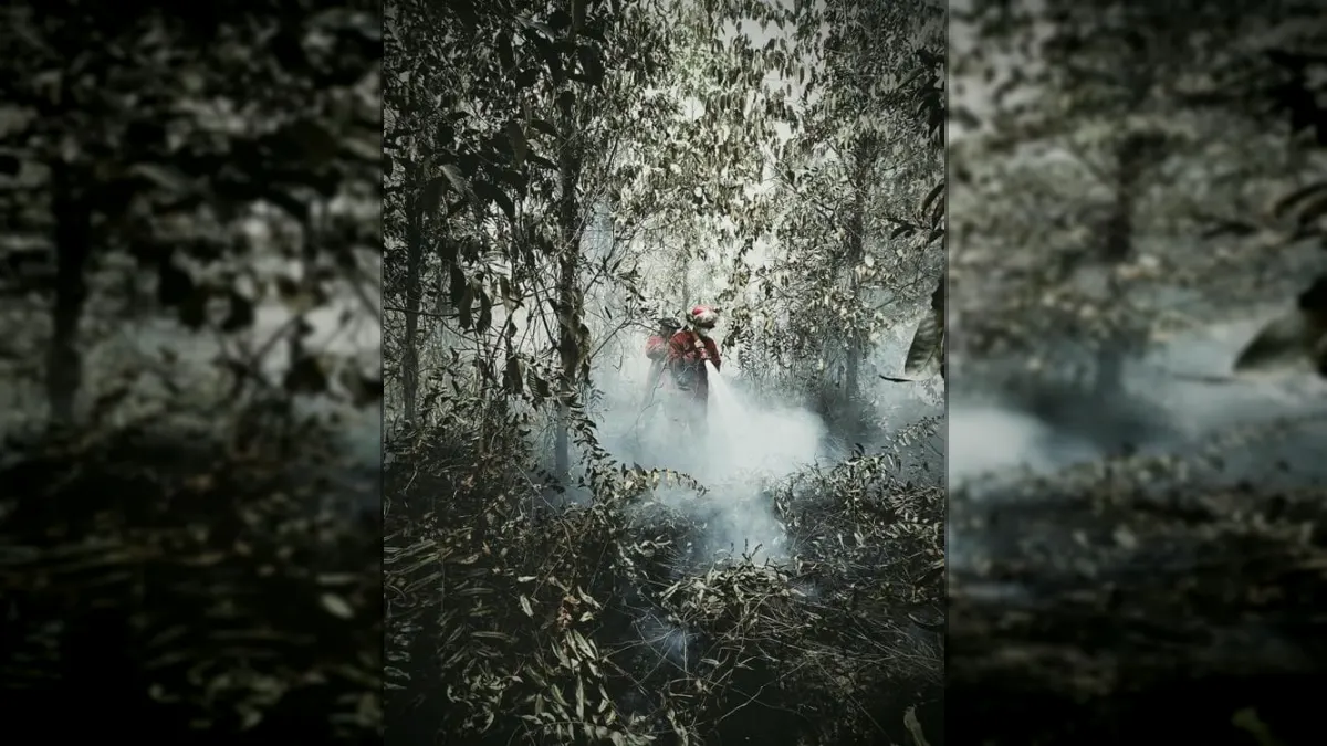
JAKARTA, GARISBUMI.com – The number of Hotspots or hot spots with a high level of confidence in Indonesia has dropped significantly in one day. However, the government has not relaxed operations to control forest and land fires (karhutla) because smoke is still suppressing air quality and visibility in a number of areas of Sumatra and Kalimantan.
Based on SiPongi data from the Ministry of Forestry sourced from the NASA Terra/Aqua, SNPP and NOAA-20 satellites, 344 high confidence Hotspots were detected nationally as of Wednesday (23/9/2026) at 21.05 WIB.
This number decreased by 588 points or around 63 percent compared to Tuesday (22/9/2026), when 932 hot spots were detected with a high level of confidence.
In the six priority provinces for handling forest and land fires, the number of high confidence Hotspots fell from 778 to 206 points in one day. The details:
• Central Kalimantan (Kalteng) 156 points, down from 643 points
• West Kalimantan (Kalbar) 33 points, down from 50 points
• South Kalimantan 11 points, down from 68 points
• South Sumatra (Sumsel) 4 points, down from 17 points
• Jambi 2 points, after previously being nil
• Riau nil, unchanged from the previous day
Central Kalimantan (Kalteng) recorded the largest decline, reaching 487 points. However, the province still has the highest number of hot spots among the six priority areas.
The Ministry of Forestry emphasized that Hotspots are an indication of surface temperature anomalies detected by satellites. This data cannot be directly interpreted as the number of fire incidents or the area of land burned.
One fire event can be detected as multiple hot spots. Therefore, every finding must be verified through a field inspection or groundcheck.
Forest and Forestry Operations in South Kalimantan Strengthened
After overseeing the handling of forest and land fires in Central Kalimantan (Kalteng), Forestry Minister Raja Juli Antoni together with the Head of the National Disaster Management Agency (BNPB) Lt. Gen. TNI Suharyanto continued monitoring in South Kalimantan, Wednesday.
The two of them visited the extinguishing of peat fires around the Sambang Lihum Mental Hospital, Banjar Regency. They also took part in an evaluation of the handling of forest and land fires together with the regional government, TNI, Polri, BPBD and related elements.
The evaluation focused on strengthening ground operations, harmonizing field data, as well as placing personnel and resources in locations that still needed treatment. The Banjar Regency Government is also preparing additional personnel to strengthen operations in vulnerable areas.
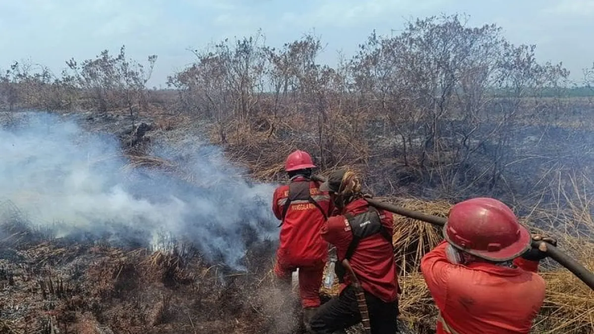
Ground operations are very important in dealing with peat fires. Embers can persist beneath the surface even though the flames above ground are no longer visible. Wetting and cooling must continue to be carried out to prevent the fire from reappearing.
The government deployed 61 air fleet units to support handling forest and land fires. A total of 17 units were used for patrols and Weather Modification Operations (OMC), while 44 other units were deployed for water bombing.
Air fleet operations consider the development of Hotspots, cloud potential, wind direction, smoke conditions, visibility and flight safety.
On land, Manggala Agni Ministry of Forestry together with BNPB, TNI, Polri, BPBD, local government, community, volunteers and the business world continue to carry out patrols, ground checks, direct extinguishing, fire blocking, wetting, mopping up and cooling.
hotspot Down, Smoke Hasn't Disappeared
A decrease in the number of hot spots does not necessarily mean that air quality will recover. Monitoring of PM2.5 particulate concentrations shows that air conditions in Indonesia still vary, from good to dangerous categories.
A number of areas in Sumatra and Kalimantan were recorded as being in the unhealthy to very unhealthy category. In several locations, air quality was even observed to be in the dangerous category.
BMKG Aviation monitoring in the early hours of Thursday (24/9/2026) also showed smoke still limiting visibility in a number of areas. In Palangka Raya and Pontianak, visibility was only around 1.5 kilometers in smoky conditions.
Visibility in Banjarmasin was recorded at around 3 kilometers, while in Jambi and Palembang around 5 kilometers. Meanwhile, Pekanbaru has a visibility of around 6 kilometers with light rain.
BMKG also noted lower visibility in a number of other locations in Kalimantan. The development of smoke and its impact on flight safety must still be monitored intensively.
This condition shows that a decrease in the number of Hotspots does not automatically mean that all fires have been extinguished. The smoke that has formed can persist and move according to wind direction and atmospheric dynamics. In peatlands, embers also have the potential to remain active below the surface.
The Ministry of Forestry urges people in affected areas to monitor air quality information and follow local government directions. When air quality worsens, people are advised to reduce outdoor activities and wear masks if they have to travel.
Special attention needs to be given to children, pregnant women, the elderly, and residents who have respiratory problems or chronic diseases.
The public and business actors are also reminded not to clear or clear land by burning. Findings of smoke, hot spots, burning activity, or affected wildlife are requested to be reported immediately to officers so that they can be handled as early as possible.
Artikel ini merupakan siaran pers resmi yang diterbitkan melalui Meja Redaksi GARIS BUMI. Materi telah melalui peninjauan editorial untuk kenyamanan dan kejelasan informasi bagi pembaca.
Share Your Thoughts Editorial Moderation Required